WX1GYX Ham Radio Station for NWS Gray Maine

WX1GYX Radios


Echolink Web Site
From Tim Watson KB1HNZ:

The Echolink conference node that is used is *NEW-ENG*. 
The important thing to keep in mind is that when we do use it, 
which is typically during larger scale events, such as Nor’easters, 
we share the conference with other SKYWARN groups,
including Burlington and Taunton. 

We use Talkgroup 8 (Region North) primarily, 
but sometimes branch off to either NH or ME statewide,
depending on the area of concern. 


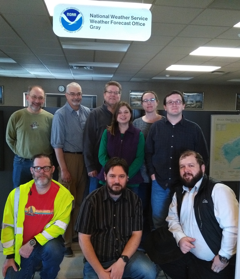
2018 SKYWARN Recognition Day WX1GYX Group Photo

2018 SKYWARN Recognition Day WX1GYX Group Photo

Weather Spotter Guides

United States National Weather Service for
Maine and New Hampshire

NWS Forecast Office-Gray http://www.weather.gov/gyx/

1 Weather Lane
Gray, ME 04039
Telephone:207-688-3216
Google Map https://goo.gl/maps/36BJeFhbhRC2
QTH: 43.8925471N 70.2571205W
NWS-Gray SKYWARN Page: https://www.weather.gov/gyx/skywarn
Area Forecast Discussion NWS- Gray, Maine AFDGYX

National Weather Service Caribou Maine http://www.weather.gov/car/

810 Main Street
Caribou, ME 04736
Telephone: 207-492-0170
Google Maps: https://goo.gl/maps/FHEaUeeYGNn
QTH: 46.868353N 68.0157389W
NWS-Caribou SKYWARN Page: http://www.weather.gov/car/Outreach_Spotters
Area Forecast Discussion NWS-Caribou AFDCAR

Weather-Ready Nation

Space Weather

Weather Data

Weather Safety

Safety After the Storm

National Weather Service Safety Tips

Seasons

Spring

Summer

Water

Hurricane

Maine Fire Danger Map http://mainefireweather.org/

Fire Danger Map page NH Department of Natural and Cultural Resources and the NH Division of Forests and Lands
National Weather Service-Gray Fire Weather Page

Links from Youtube Video on Forest Service Upgrades

Incident Response Pocket Guide - April 2018
Wildland Fire Assesment System
Eastern Area Coordination Center (EACC)
NFDRS PocketCard is a tool for field personnel to locally track outputs of the National Fire Danger Rating System (NFDRS)
Canadian Wildland Fire Information System
Manual for the Rainwise MK-III LR Weather Station(pdf)

Lightning Awareness

Fronts

Front Symbol
Frontogenesis

Fujiwhara effect-NWS
Fujiwhara effect-Wiki

NOVA Prediction by the Numbers Season 45 Episode 6 | 53m 6s

Winter

Community Collaborative Rain, Hail and Snow

Snow Types

Snow Measurements

NWS Gray WFO Snow Measurement Guidelines
Snow Measurements Guideline 2014
CoCoRaHS is an acronym for the Community Collaborative Rain, Hail and Snow Network

Long Range Winter Forecast

Winter Car Survival

Ready Wisconsin Car Survival Kit List

Ice Storm and Precipitation Types

Precipitation Types
Ice Storm on Wikipedia

Cold Wx Prep

prep for cold
prep pets for cold
Wyoming Winter Weather Awareness Day

United States Antarctic Program (USAP)

Mount Washington Observatory

Wind Chill and Winter Weather Safety

Wind Chill

Wind Chill Safety
Cold Weather Safety

Frostbite

http://medlineplus.gov/frostbite.html
http://www.cdc.gov/disasters/winter/staysafe/frostbite.html

Hypothermia

http://www.cdc.gov/disasters/winter/staysafe/hypothermia.html
http://dphhs.mt.gov/Portals/85/dsd/documents/DDP/MedicalDirector/Hypothermia.pdf

Amundsen-Scott South Pole Station

South Pole Wx